Web Mapping Apps
Interactive maps with search, filters, drawing, and role‑based access.
- Mapbox/Leaflet/ArcGIS JS
- Offline tiles & caching
- Print/export tools


We design geospatial systems that visualize assets, monitor operations, and power planning across government, utilities, logistics, and more.
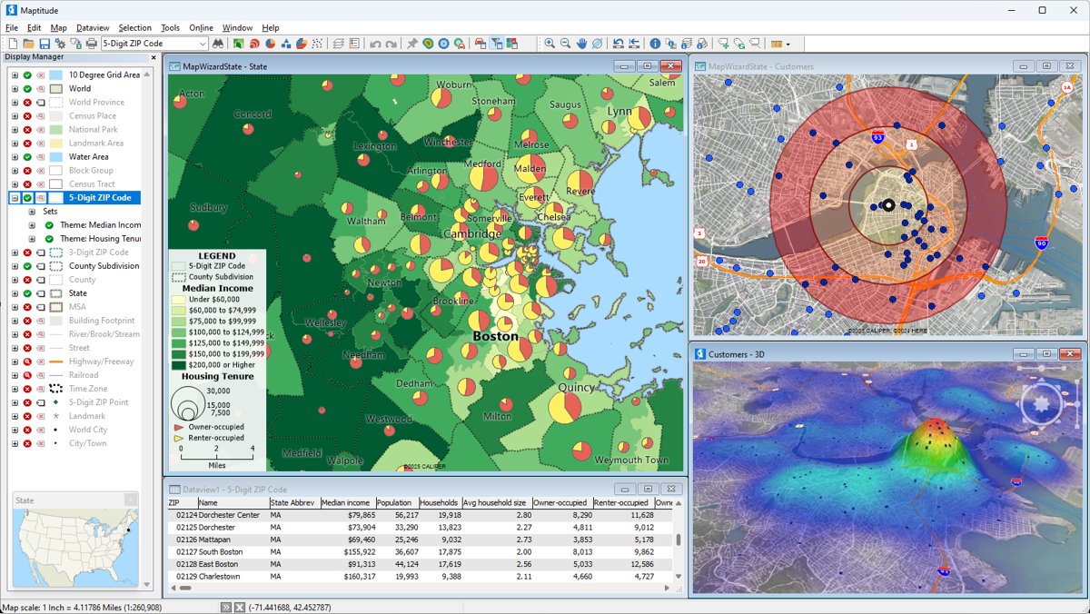
From field collection to spatial analytics and dashboards.
Interactive maps with search, filters, drawing, and role‑based access.
Buffers, overlays, network tracing, and spatial statistics for decisions.
Forms with geotags, offline sync, photo capture, and QA workflows.
Operational dashboards with alerts, KPIs, and map‑linked charts.
Clean, transform, and sync shapefiles, CAD, imagery, and tabular data.
ArcGIS Enterprise, GeoServer, and cloud‑native stacks with CI/CD.
A few examples from real‑world deployments.
Water, power, telecom, and facilities with maintenance history and photos.
Field forms, routing, and dashboards for compliance and SLAs.
Live incident maps, staging areas, and resource tracking.
Model networks, outages, and crew assignments.
Demographics, drive‑times, and suitability analysis.
Real‑time GPS, geofences, and proof‑of‑service analytics.
Start small or roll out a complete platform.
Data audit, base map, and a simple web app.
Editable layers, field forms, and KPIs.
Full stack with integrations and CI/CD.
Transparent milestones and handoff.
Inventory sources, quality checks, and a target schema.
Symbology, basemaps, and app wireframes for feedback.
APIs, ETL jobs, security, and role permissions.
Hosting, monitoring, and team enablement.
Ongoing updates, monitoring, and help desk.
Cadastre, roads, and utility assets kept current.
Workshops for editors, viewers, and admins.
Licensing, hosting, and data ownership—clarified.
You own your data, schemas, and outputs. We establish export paths and backups so you’re never locked in.
No. We support Esri and open‑source stacks. We’ll recommend what best fits your team and budget.
Yes—Collector, Survey123, QField, or custom apps with offline tiles and queued edits.
Cloud, on‑prem, or hybrid. We handle SSL, SSO, backups, and monitoring.
Tell us about datasets, users, and goals—we’ll outline a plan.
